Summary
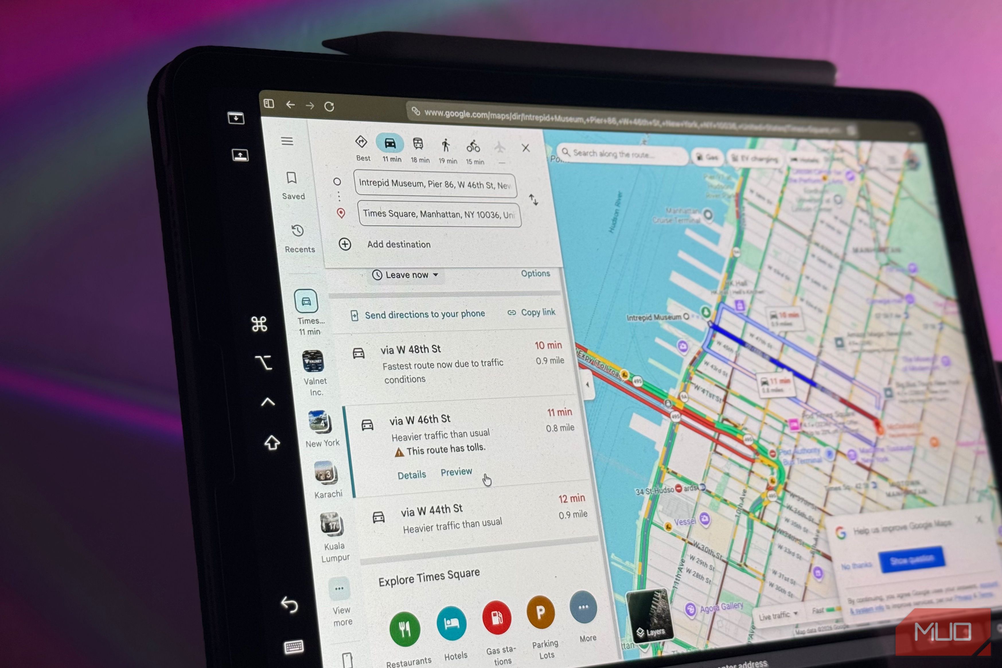
As the designated late friend who takes hours to get dressed and is always fashionably behind schedule, I mentally rely on Google Maps’ ETA. I check it way before I actually need to leave, lock in that comforting little number (okay, 20 minutes, I still have time), and build my whole schedule around it. Then I finally head out, and the second I do, that number balloons because traffic has appeared out of nowhere. Instead of, you know, actually leaving for my destination, I almost always sit there wondering: how does Google Maps know that traffic is there before anyone’s had the chance to report it? I’ve had that thought so many times, and I finally decided to get to the bottom of it (naturally, while still running late). Your phone is the one telling on you You’ve been a traffic snitch this whole time If you’ve been using Google Maps for a while now, you’ve likely noticed three colors painted over the roads when you begin a journey: green, orange and red. Green means the route you’re heading to is clear, orange indicating its beginning to slow down, and red warning you that the traffic has fully set in. Google Maps doesn’t use a network of traffic cameras watching the roads 24/7 to determine which streets get which color or have a reporter parked on every corner reporting back to the app. What it’s actually doing is far simpler in reality. Google Maps is simply watching phones, including yours. When you first install Google Maps, the very first thing you’re asked to do is give it access to your location. Of course, there isn’t a way to use Google Maps without it…since a navigation app that can’t see your location can’t really help you navigate. The moment you grant Google Maps this permission, you become of the millions of sensors feeding the whole system. Every time you drive with Google Maps open and your location enabled, your phone sends anonymous bits of data back to Google describing how fast you’re moving. Google doesn’t know who you are or where you’re going, and it’s just a little ping that says “this device is crawling along at 8 mph right here.” At an individual level, this isn’t very useful. However, you’re far from the only one doing it. Google explained this all the way back in 2009 in a blogpost titled The bright side of sitting in traffic: Crowdsourcing road congestion data. Google combines the speed data from thousands of phones moving around a city at the same time. On their own, each ping is meaningless, but together they reveal exactly which roads are flowing and which ones are backed up. Here’s how that works in practice. Say a particular stretch of road normally sees phones passing through it at 60 mph. If Google notices a hundred phones moving across that same stretch at 12 mph, it can conclude there’s a traffic jam. No one had to open the app and report it, no camera had to catch it, and no sensor had to register it. The slow speed itself is what tells Google there’s traffic. Google applies this same method to every road in a city and updates it continuously, which produces the live traffic layer you see on the map. AI has made the system even smarter Now it knows you’re stuck before you do There’s a limit to what live speed data can do, though. Knowing that a road is jammed right now tells you what’s happening this second, but it doesn’t tell you what that road will look like ten or fifty minutes into your drive. This is exactly the part that matters when you’re planning whether you’ll make it on time. This is where Google Maps stops just reporting traffic and starts predicting it. To do that, Google Maps looks at historical traffic patterns for a road over time. A given stretch might typically run at 65 mph between 6 and 7 AM but drop to 15-20 mph in the late afternoon. Google combines that historical record with the live conditions coming in from phones, and uses machine learning to predict what traffic will actually be like along your route at the time you’ll be driving it. Ultimately, this is why you’ll find Google rerouting you: it knows the original route you’re on is about to get congested, even if it’s flowing freely right now, and it can send you down a lower-traffic alternative before you ever hit the jam. The way everything works together is brilliant While there’s definitely the element of all of this being a privacy trade-off, Google has emphasized that the data is anonymous. It claims that it only uses speed and location to calculate traffic, combines everyone’s data in an area, so no single phone can be picked out, and deletes the start and end points of every trip so it can’t trace where an anonymous car came from or went. However, you do have to admit that the way all of it works is impressive, and it’s exactly the way AI is supposed to be used.